Spectacular mountain summits
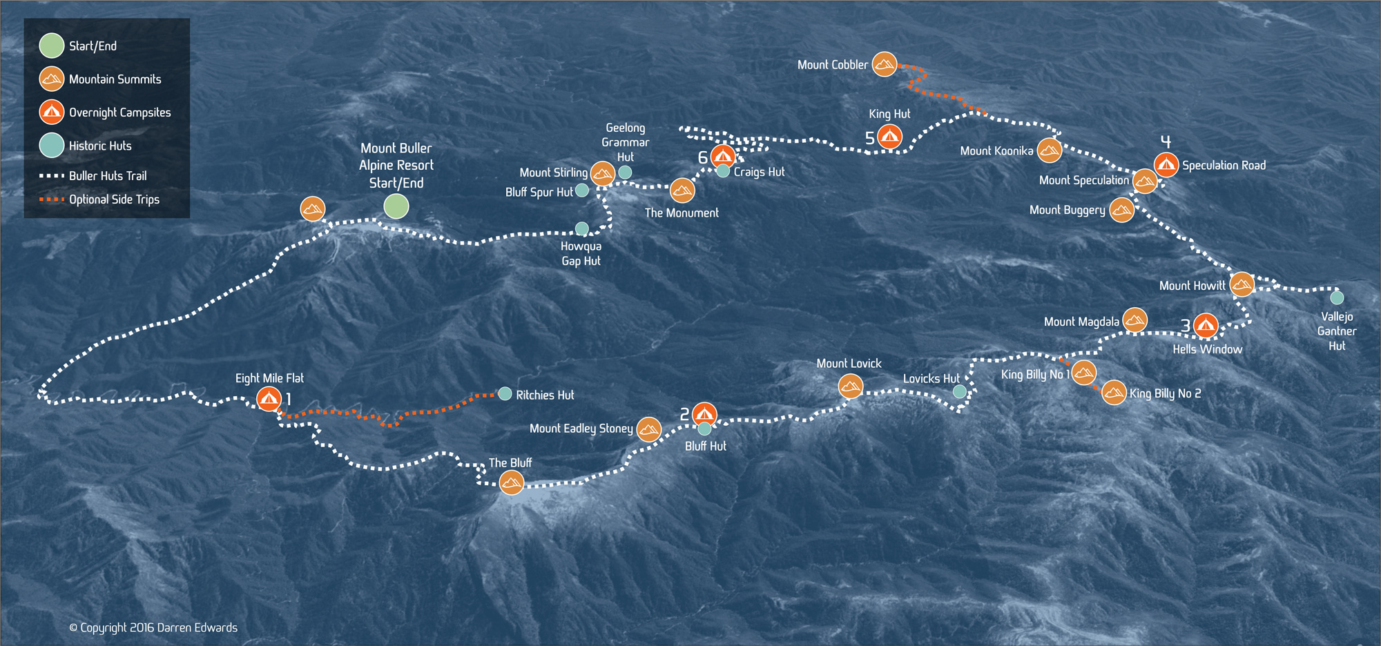
The Buller Huts Trail traverses some of Victoria’s most spectacular mountain summits.
These include Mount Buller, The Bluff, Mount Eadley Stoney, Mount Lovick, Mount Magdala, Mount Howitt, Mount Buggery, Mount Speculation, Mount Koonika, The Monument and Mount Stirling. There are also optional side trips to King Billy 1, King Billy 2 and Mount Cobbler if you are looking to extend your trek.
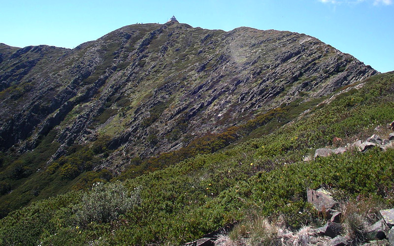
Mount Buller
Elevation 1805m
Discover more
Mount Buller
Mount Buller is a mountain peak in the Victorian Alps, Australia. It is located in the Alpine National Park, approximately 180 kilometers (110 mi) northeast of Melbourne. Mount Buller has an elevation of 1,805 meters (5,922 ft), and is one of the highest peaks in the region.
Mount Buller is a popular destination for skiing, snowboarding, hiking, and mountain biking. It has a hemiboreal climate with cold, snowy winters and cool summers. In winter, Mount Buller is transformed into a winter wonderland. The mountain is covered in snow, and the ski resort comes to life. Mount Buller has over 300 hectares (740 acres) of skiable terrain, with runs for all levels of skiers and snowboarders. The resort also has a number of other facilities, including a snow park, a cross-country skiing area, and a toboggan run.
In summer, Mount Buller is a popular destination for hiking, mountain biking, and camping. There are a number of trails that wind through the alpine forests and meadows, offering stunning views of the surrounding mountains.
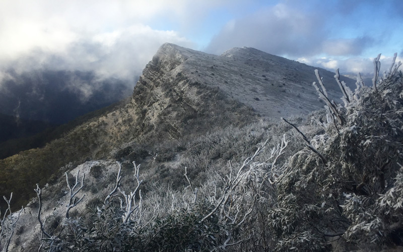
The Bluff
Elevation 1725m
Discover more
The Bluff
The Bluff is a mountain peak in the Victorian Alps, Australia. It is located in the Alpine National Park, approximately 190 kilometers (120 mi) northeast of Melbourne. The Bluff has an elevation of 1,725 meters (5,659 ft), and is one of the highest peaks in the region.
The Bluff is a popular destination for hiking and bushwalking. The trail to the summit is steep and challenging, but the views from the top are well worth the effort. On a clear day, hikers can see for miles in every direction, with views of the surrounding mountains, valleys, and lakes.
The Bluff is also a popular spot for rock climbing and abseiling. The cliffs on the north face of the mountain are some of the most challenging in the Victorian Alps, and attract climbers from all over Australia.
In winter, The Bluff is often covered in snow.
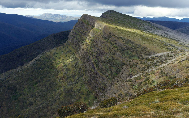
Mount Eadley Stoney
Elevation 1665m
Discover more
Mount Eadley Stoney
Mount Eadley Stoney is a mountain peak in the Victorian Alps, Australia. It is located in the Alpine National Park, approximately 180 kilometers (110 mi) northeast of Melbourne. Mount Eadley Stoney has an elevation of 1,665 meters (5,463 ft), and is one of the highest peaks in the region.
The mountain is named after Eadley Stoney, a pioneer drover who settled in the valleys beneath Mount Buller in the early 1800s. Stoney was a skilled bushman and explorer, and he is credited with opening up the Victorian High Country to European settlement.
Mount Eadley Stoney is a popular destination for hiking, bushwalking, and camping. The trail to the summit is steep and challenging, but the views from the top are well worth the effort. On a clear day, hikers can see for miles in every direction, with views of the surrounding mountains, valleys, and lakes.
In winter, Mount Eadley Stoney is often covered in snow.
Mount Lovick
Elevation 1648m
Discover more
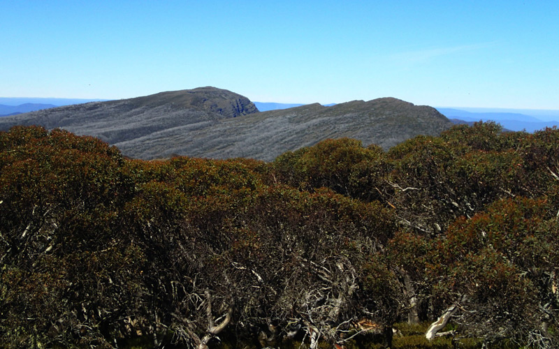
Mount Lovick
Mount Lovick is a mountain peak in the Victorian Alps, Australia. It is located in the Alpine National Park, approximately 180 kilometers (110 mi) northeast of Melbourne. Mount Lovick has an elevation of 1,684 meters (5,525 ft), and is one of the highest peaks in the region.
The mountain is named after Charlie Lovick, a pioneer mountain cattleman who settled in the area in the early 1900s. Lovick was a skilled horseman and bushman, and he is credited with helping to open up the Victorian High Country to European settlement.
Mount Lovick is a popular destination for hiking, bushwalking, and camping. The trail to the summit is steep and challenging, but the views from the top are well worth the effort. On a clear day, hikers can see for miles in every direction, with views of the surrounding mountains, valleys, and lakes.
In winter, Mount Lovick is often covered in snow.
Mount Magdala
Elevation 1719m
Discover more
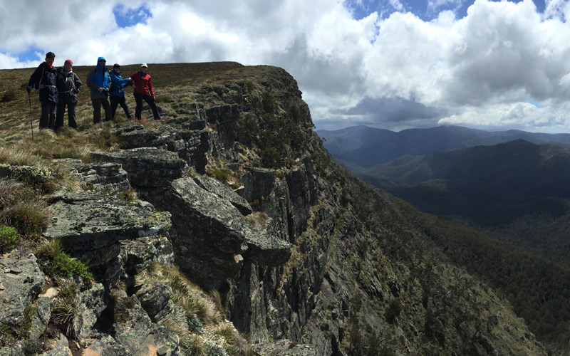
Mount Magdala
Mount Magdala is a mountain peak in the Victorian Alps, Australia. It is located in the Alpine National Park, approximately 170 kilometers (106 mi) northeast of Melbourne. Mount Magdala has an elevation of 1,719 meters (5,640 ft), and is one of the highest peaks in the region.
The mountain is named after the Magdala Pass, a steep and challenging mountain pass that leads to the summit. The pass was named after Mary Magdalene, a follower of Jesus Christ.
Mount Magdala is a popular destination for hiking, bushwalking, and camping. The trail to the summit is steep and challenging, but the views from the top are well worth the effort. On a clear day, hikers can see for miles in every direction, with views of the surrounding mountains, valleys, and lakes.
In winter, Mount Magdala is often covered in snow.
Mount Howitt
Elevation 1742m
Discover more
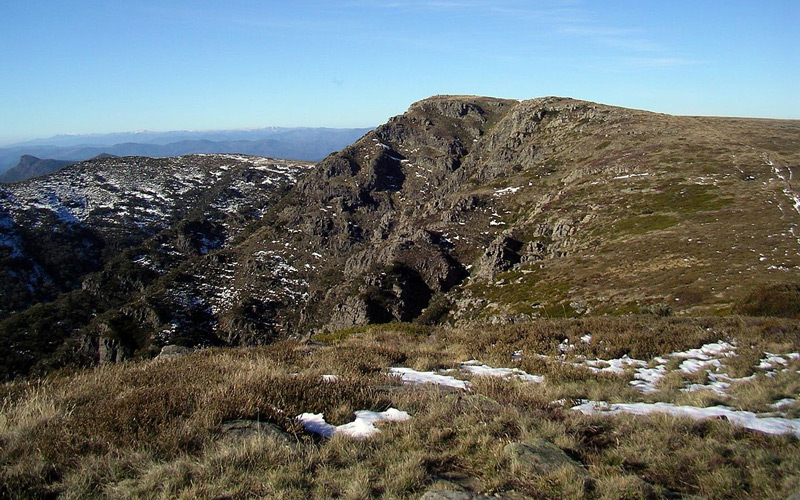
Mount Howitt
Mount Howitt is a mountain peak in the Victorian Alps, Australia. It is located in the Alpine National Park, approximately 180 kilometers (110 mi) northeast of Melbourne. Mount Howitt has an elevation of 1,746 meters (5,715 ft), and is one of the highest peaks in the region.
Mount Howitt is named after Alfred William Howitt, a surveyor and geologist who explored the Victorian Alps in the 1860s. Howitt was the first European to climb Mount Howitt, and he is credited with opening up the Victorian High Country to European settlement.
Mount Howitt is a popular destination for hiking, bushwalking, and camping. The trail to the summit is steep and challenging, but the views from the top are well worth the effort. On a clear day, hikers can see for miles in every direction, with views of the surrounding mountains, valleys, and lakes.
In winter, Mount Howitt is often covered in snow.
Mount Buggery
Elevation 1595m
Discover more
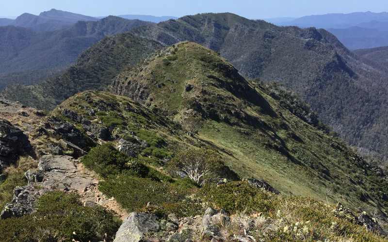
Mount Buggery
Mount Buggery is a mountain peak in the Victorian Alps, Australia. It is located in the Alpine National Park, approximately 170 kilometers (106 mi) northeast of Melbourne. Mount Buggery has an elevation of 1,595 meters (5,233 ft) above sea level, and is one of the highest peaks in the region.
The mountain is named after a drover who is said to have been lost there in the early 1800s. The drover was eventually found, but he was so disoriented that he could not remember his name. The locals nicknamed him “Buggery”, and the name stuck.
Mount Buggery is a popular destination for hiking, bushwalking, and camping. The trail to the summit is steep and challenging, but the views from the top are well worth the effort. On a clear day, hikers can see for miles in every direction, with views of the surrounding mountains, valleys, and lakes.
In winter, Mount Buggery is often covered in snow.
Mount Speculation
Elevation 1650m
Discover more
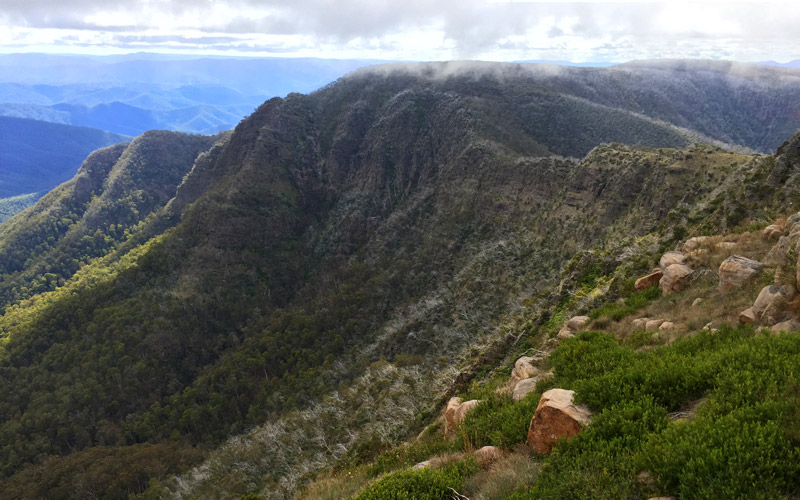
Mount Speculation
The mountain is named after the fact that there was once speculation about whether it was the highest peak in the Victorian Alps. This speculation was finally resolved in the 1860s, when Alfred William Howitt climbed the mountain and determined that it was not the highest peak.
Mount Speculation is a popular destination for hiking, bushwalking, and camping. The trail to the summit is steep and challenging, but the views from the top are well worth the effort. On a clear day, hikers can see for miles in every direction, with views of the surrounding mountains, valleys, and lakes.
In winter, Mount Speculation is often covered in snow.
Mount Koonika
Elevation 1545m
Discover more
Mount Koonika
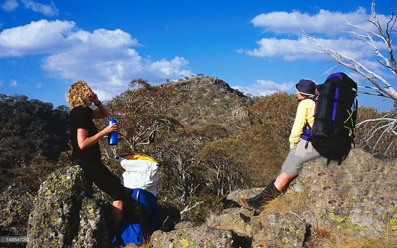
Mount Koonika is one of the lesser known peaks situated close to the Terrible Hollow and Cobbler Plateau. The nearest towns to Mount Koonika are the town of Mansfield (48.4km), the town of Bright (51.2km) and the village of Porepunkah (51.7km).
On a clear day, hikers can see for miles in every direction. From the summit of Mount Koonika you are rewarded with views of Mount Speculation, The Crosscut Saw, Mount Cobbler, and many other surrounding mountains, valleys, and lakes.
The Monument
Elevation 1570m
Discover more
The Monument
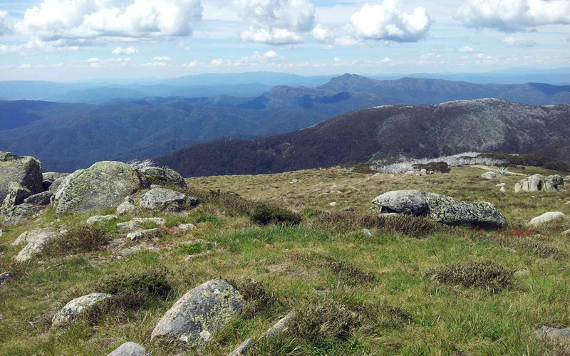
The Monument is a rock formation located near Mount Stirling in the Victorian High Country, Australia. The Monument has an elevation of 1,570 meters (5,151 ft). It is a popular destination for hiking and bushwalking.
The Monument is a remnant of a volcanic eruption that occurred millions of years ago. The eruption created a lava flow that cooled and hardened, forming a hard basalt rock. The Monument itself is approximately 50 meters (164 feet) high and 100 meters (328 feet) long.
The trail to The Monument is steep and challenging, but the views from the top are well worth the effort. On a clear day, hikers can see for miles in every direction, with views of Mount Stirling, Mount Buller, and Mount Howitt.
Mount Stirling
Elevation 1749m
Discover more
Mount Stirling
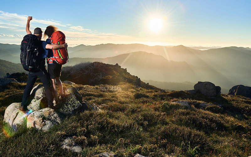
Mount Stirling is a popular destination for hiking, bushwalking, camping, skiing, and snowboarding. It is also a home to a variety of wildlife, including kangaroos, wallabies, wombats, echidnas, and a variety of birdlife.
In the summer, Mount Stirling is a popular destination for hiking and bushwalking. There are a number of trails to choose from, ranging from easy walks to challenging hikes. The most popular trail is the Mount Stirling Summit Trail, which offers stunning views of the surrounding mountains and valleys.
In the winter, Mount Stirling is a popular destination for skiing and snowboarding. There are two ski resorts on Mount Stirling: Mount Stirling Alpine Resort and Mount Buller Alpine Resort. Mount Stirling Alpine Resort is a smaller and more family-friendly resort, while Mount Buller Alpine Resort is a larger and more challenging resort.
The following mountain summits can be attempted during optional side trips. Side trips will extend the overall length and duration of the trek. Check the 7-day itinerary for more information.
King Billy 1
Elevation 1690m
Discover more
King Billy 1
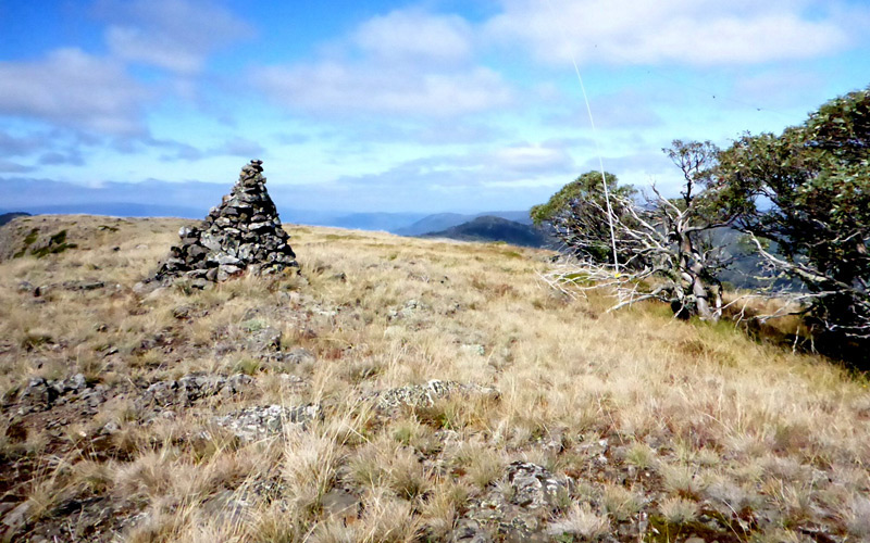
King Billy 1 is a popular destination for hiking, bushwalking, and camping. The trail to the summit is relatively short and easy, making it a good option for hikers of all fitness levels. The trail winds through alpine meadows and forests, before reaching the summit, which is marked by a cairn.
From the summit of King Billy 1, hikers can enjoy panoramic views of the Victorian High Country. On a clear day, it is possible to see Mount Buller, Mount Stirling, and Mount Howitt. Hikers can also see the Bogong High Plains and the upper reaches of the Goulburn River.
King Billy 1 is a popular destination for camping, with a number of campsites located near the summit. The campsites are well-maintained and offer stunning views of the surrounding mountains.
King Billy 2
Elevation 1685m
Discover more
King Billy 2
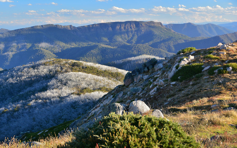
King Billy 2 is a popular destination for hiking and bushwalking. The trail to the summit is steep and challenging, but the views from the top are well worth the effort. On a clear day, hikers can see for miles in every direction, with views of Mount Buller, Mount Stirling, and Mount Howitt.
King Billy 2 is also home to a variety of wildlife, including kangaroos, wallabies, wombats, echidnas, and a variety of birdlife. In winter, King Billy 2 is often covered in snow, making it a popular destination for snowshoeing and cross-country skiing.
Mount Cobbler
Elevation 1628m
Discover more
Mount Cobbler
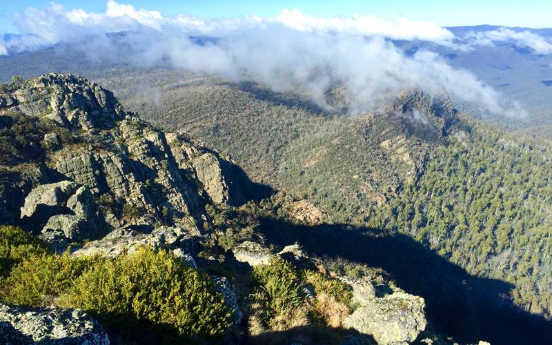
The mountain is named after its resemblance to a cobbler’s last. The trail to the summit is steep and challenging, but the views from the top are well worth the effort. On a clear day, hikers can see for miles in every direction, with views of Mount Buller, Mount Stirling, and Mount Howitt.
In winter, Mount Cobbler is often covered in snow.

